Data Downloads
Geographic data
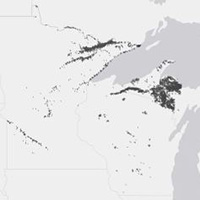
Sections: a map layer containing a polygon for each section of the Public Land Survey System in Wisconsin, Minnesota, and Michigan in which we have a sample. PLSS Sections are approximately square, six miles on a side.
Download sections layer (zipped shapefile)Tables
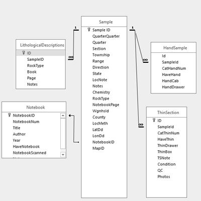
Tables: five tables containing all sample data (Hand Samples, Thin Sections, Notebooks, Lithological Descriptions, and Ledgers)
Download tables (zipped folder of CSVs)